| < Previous page | Next page > |
Trimble Machine (.gps)
This option allows you to import data from a Trimble (.gps) file. This file is the type used by Trimble Field Level 11 controllers. These files contain the design as created by a number of different software pakages. It contains there design, the cut/fill and the natural surface. Everything in the file is relative to the master bench that the file contains.
As a user; if a contractor has only supplied you with this file; then you can restore your natural surface data etc. It also gives you the ability to take a design for Trimble; import it into Ezigrade and export a control file compatible with a different controller. For example AMW.
Once you select this option you are presented with the following dialog box. The .gps data format contains a grid of data points. Two grids if we have cut/fill data as well. These grids can get quite large. If you are only after a quick look at the data we suggest you tick the "Thin points to keep job less than 50000". If you want an accurate version untick and all the points are imported.
Once dialog is displayed; click the "Check Data" button and some of the internal data is displayed within the dialog. Normally you don't want any NULL heights imported. These are points that make up the grid but may be along an edge and it doesn't have a valid height associated with it.
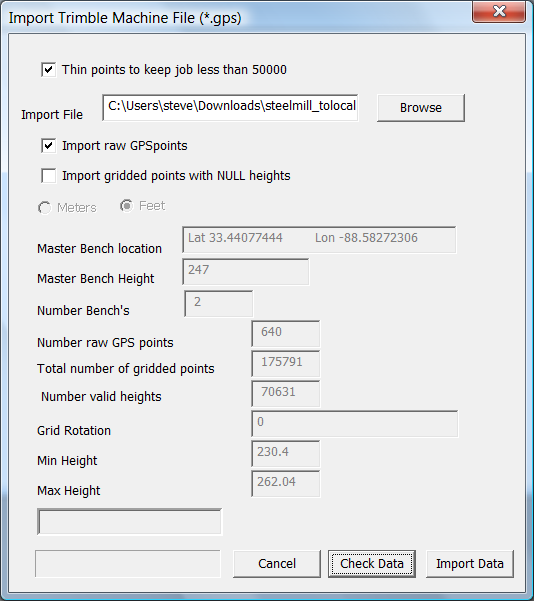
Once you click on the "Import Data" the data is imported into the cdsdat file and displayed.
|