| < Previous page | Next page > |
GPS Menu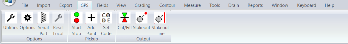
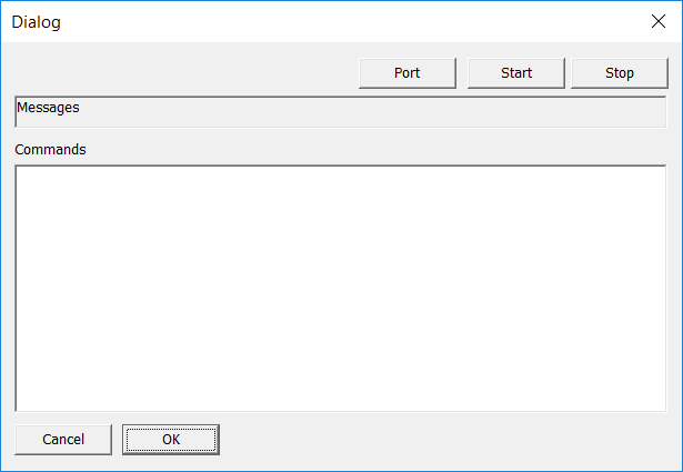
Utilities: Brings up a dialog box where we can set the port and make sure communications with GPS device are happening:
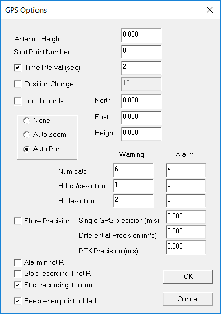
Options: This brings up a dialog where we fill in things like antenna height, alarms and whether we auto zoom and pan etc
Start/Stop: we can either use GPS data or ignore it.
Add Point: manually add a point to the database.
Cut/Fill: Display current cut or fill. ie difference in GPS height to current natural surface height.
Stakeout Point: Stake out to a point docking window
Stakeout Line: Stale out to a line docking window.
|