| < Previous page | Next page > |
Picking up Survey Data with EzigradeSet the Serial Port.
From the File -> GPS -> Serial Port and set this port value to the same as in the previous testing dialog.
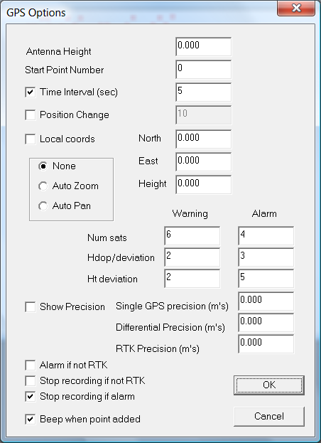
Set up Appropriate Options.
You have the option of picking up points every so many seconds or when the distance changes by a certain value (meters or feet - though feet not yet done). If you just want a cursor on the screen representing the GPS position then untick both these options.
You can set local coordinates if required and Ezigrade can auto scroll and zoom as we go. However you can still zoom manually as points are being picked up.
The rest of the details allow you to set warnings and alarms on the data coming in. It is important to make sure these are set to your requirements. For example it is probably important to stop recording if RTK is not present.
Pick up the Data
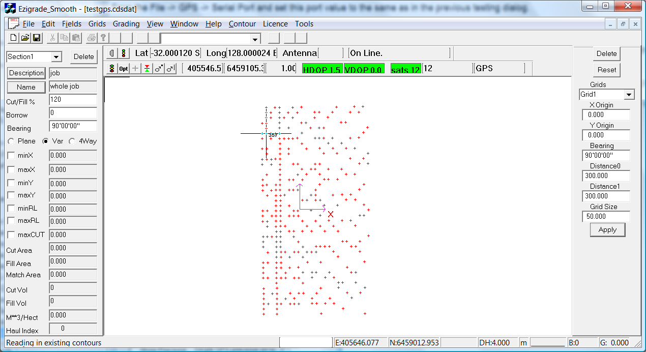
Click on the File -> GPS -> Pickup
This now imports the data from the serial port depending on the options set. The small black cursor is the GPS position. We also have a new indicator bar that gives us current lat/longs number of satellites etc. The data at present is automatically converted to UTM coordinates at present. If you are from the States and you need State Plane then let us know and we will get it implemented.
Ezigrade auto backs up every 150 points incase anything goes wrong.
 |